3D photomaillages – Lyon, Marseille, Nice, Toulouse, Lille, Pau… they trust IGO
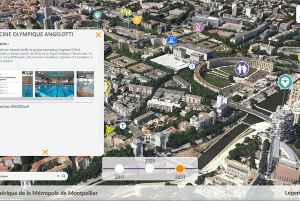
Create the digital twin of your territory and have a realistic 3D digital model to integrate BIM projects, contextualize issues, cross multi-source information: IoT, webservices, GIS, heritage,….
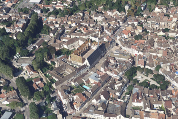
Lyon, Marseille, Toulouse, Lille, Pau, Nice, Cannes, Antibes and Bastia are entrusting IGO with the production of Photomaillages (also known as Mesh or 3D orthophotoplanes) for their territories in 2019 and 2020.
This involves the supply of 3D Photomaillage for the entire territory (>500km for Lyon, Marseille and Nice) and/or Photomesh3D tools and associated services to produce 3D models of territories in complete autonomy.
For communication and decision-support purposes, our customers can quickly access a highly realistic, up-to-date 3D model, based on their latest aerial photos.
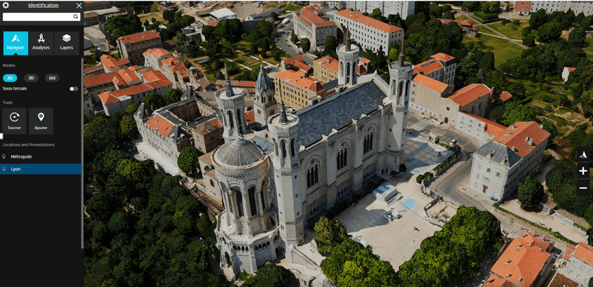
With the model delivered in Esri, Skyline, Terra Explorer, 3Dtills (open source Cesium) and OBJ (open standard) formats, they can distribute it on the web. The associated free Terra Explorer viewer lets them visualize the Photomaillage in real-time 3D, interact with the territory, benefit from all the solution’s analysis tools (BIM import, GIS, intervisibility study, road vector layer plating, etc.) or create videos or 3D presentations. With Terra Explorer plus or pro, they benefit from a complete 3D digital model or platform solution.
Visualize Antibes with TerraExplorer