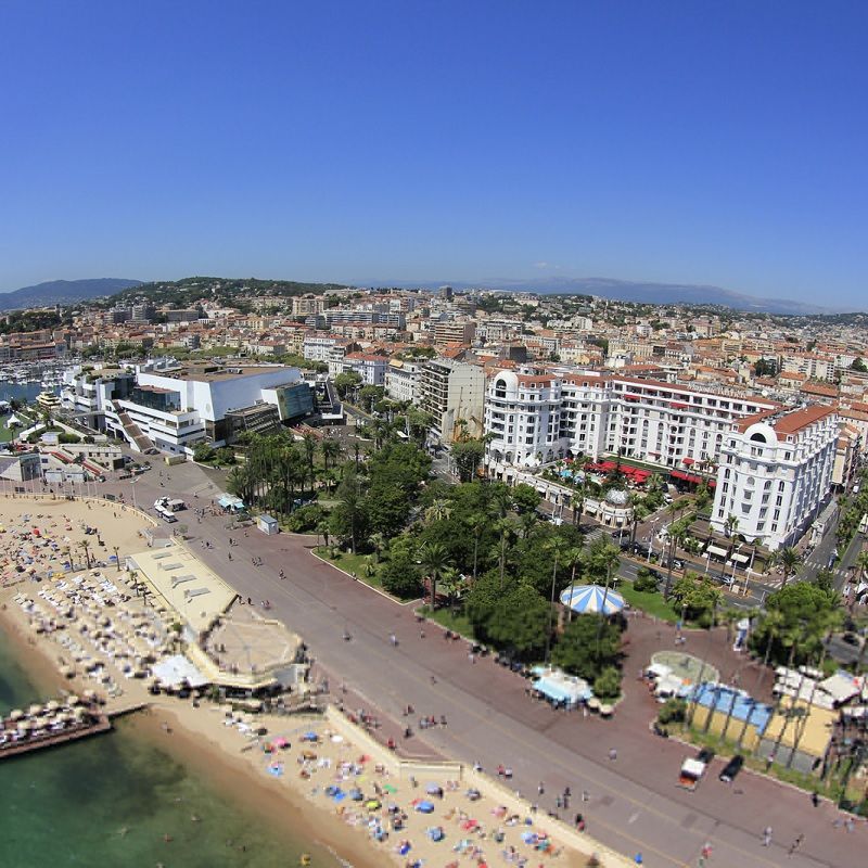
What are the activities of the City of Cannes’ GIS department?
“The Geographic Information Systems Department manages all projects and activities involving GIS, 3D urban models, topography, bathymetry and CAD products.
Through a range of services, we are available to our users for installation, training on our tools and support in the realization of their projects. Our missions are rich and varied: thematic/spatial analyses, 3D architectural project modeling, bathymetric surveys, provision of 2 permanent GPS stations guaranteeing high-precision topographic work, etc.
We administer reference data, in particular aerial photographs, the computerized cadastral plan, data from exchange agreements (drinking water and wastewater networks, etc.) and all thematic data entered by our departments.
How do 3D tools help you manage your assignments?
“The use of 3D has become essential in urban planning, in the realization of development projects and in the way we apprehend our territory; we can no longer think and design only in 2 dimensions. 3D is part of new approaches to analyzing, understanding and creating the spaces of tomorrow.”
What other operational department also benefits from the use of 3D?
“Around twenty people from our technical departments (architecture, roads, works, etc.) have been trained to use, consult and create 3D visuals and videos. The approaches are very different depending on the field, such as assessing the impact of a new building on surrounding visibility, identifying the most suitable roofs for photovoltaic installations, matching urban planning zoning with building heights, etc.”
What were the main strengths and differentiating features of IGO’s solutions that were appreciated?
“IGO’s expertise and knowledge of the 3D domain enabled us to adopt a complete software suite enabling us to manage our entire 3D urban model in total autonomy, from the management of our CityGML data to the distribution of our model on our Web portal, via “professional” tools for our internal users.
Historically, the city of Cannes was one of the first local authorities to start modeling its territory and acquiring 3D visualization tools. The lack of synergy between the worlds of GIS and 3D has always been an obstacle to the development of our uses, and we wanted to have a genuine 2D / 3D GIS whose vocation would not only be to communicate, but a real tool at the service of our users. In this way, users will no longer be satisfied with simply displaying a city facility in plan mode, but will also be able to view it in 3 dimensions, measure its height, analyze the field of vision, etc. “.
Why didn’t you opt for the 3D solution offered by your GIS publisher?
“Our editor, a leader in the field of Geographic Information Systems, offers powerful 3D spatial analysis tools.
However, the performance and suitability of Skyline’s tools for our needs were decisive in our choice.
The support of our CityGML 3D urban model in the update cycle, the interoperability with all 3D and GIS formats and the functional richness of this software suite were essential.”
What are the main future uses for the 3D system you’ve set up?
“We want to use the model as a multi-disciplinary tool for decision-making, project design and the enhancement of our territory.