Improving decision support
Integrating BIM into a 3D digital model or platform enables :
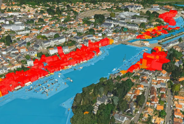
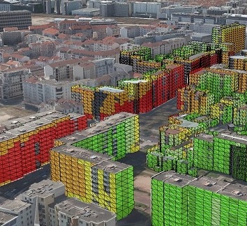
- Understand the impact of building or infrastructure development on the local environment.
- Measure the interactions of development with the globality of a territory on a regional or metropolitan scale.
- Monitor the environmental impact of buildings and infrastructures throughout their lifecycle.
Improve your business, develop new uses
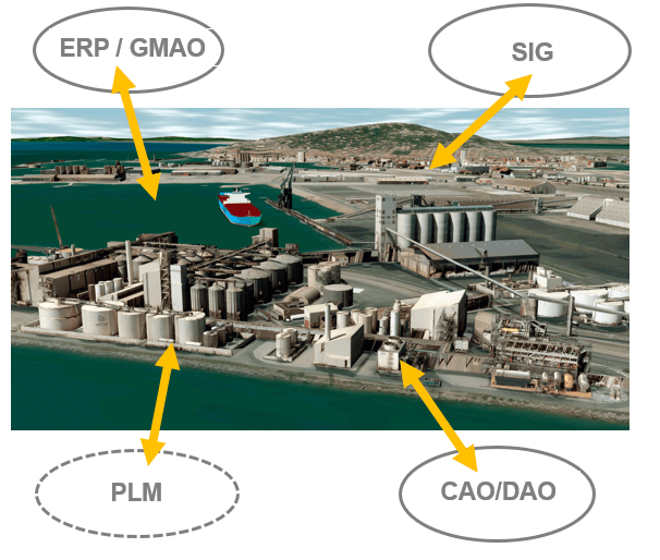
BIM & Territories convergence for :
- Improve professional efficiency.
- Develop a Smart Territories, City or Grid approach with CMMS and lifecycle management.
- Integrate 3D into business applications throughout the lifecycle of buildings, infrastructures and facilities.
- Have a global vision of developments and their impact.
Technological convergence with the integration of territory and BIM into :
- Smart Territories, City & Grid global approach platforms,
- Business applications
- CMMS development and lifecycle management
The values of the IGO solution: interoperability and standards to develop uses
The integration of BIM, with its associated attribute database, enables the development of a genuine territorial data platform with Big Data and IoT management.
Standard exchange formats: CityGML for the 3D territory model and IFC/FBX/Revit for BIM.
- Big Data and IoT management: real-time querying of attributes linked to built BIMs (or infras) and territories (GIS and geo-databases).
- Native BIM and GIS convergence.
- Convergence with business tools/applications: interact with data, real-time import/export, queries… to develop new uses: business services and applications.
- Multi-scale visualization: aerial and pedestrian.
- Web distribution, 3D cloud, simplified 3D interface for easy access to information.