
The digital twin, a reflection of a territory

It's only a short step from reality to digital twin

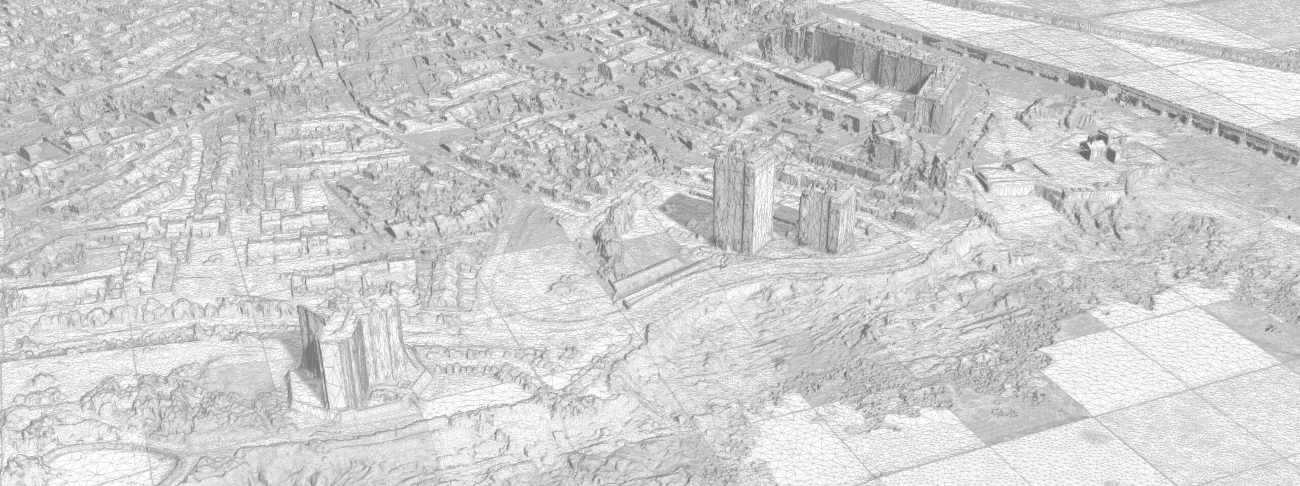
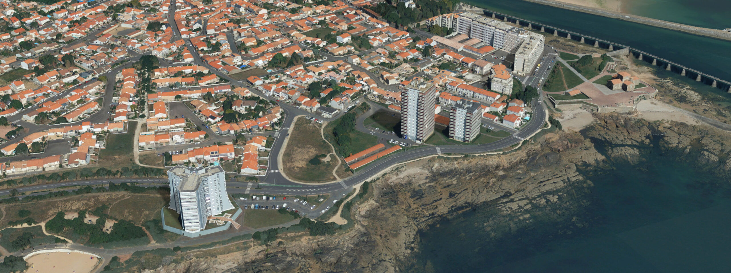
The digital twin of an industrial site or territory can be defined as its virtual replica. It goes beyond simple visualization to represent its operation in real time and understand its evolution. As a realistic 3D map of the area and a decision-making tool, the digital twin enables you to visualize and understand the projects and challenges facing local players.

In this sense, it complements concepts and technologies such as GIS or BIM, and represents a major innovation in photorealistic modeling of large territories.

From ground or aerial data acquisitions, IGO uses photos and LiDAR to create a high-resolution textured 3D photo-mesh. The teams also offer data base management services and tools for exploiting the digital twin.

The digital twin at the service of your businesses

The digital twin offers an infinite number of scenarios that enable beneficiaries to make informed decisions in response to ethical, legal, economic, technological, governance and cybersecurity issues. As a result, territories are more resilient and able to anticipate future developments.

How can I get a concrete simulation of my project in its real environment?

The digital twin is a powerful tool for project planning and management. By creating an accurate virtual replica and using real-time data, it enables scenarios to be simulated, transformations to be anticipated and decision-making processes to be optimized, while promoting effective communication between stakeholders.

  • Urban planning
  • Solar cadastre
  • Energy management
  • Urban traffic management
  • Street lighting

How can I optimize my asset management?

The digital twin has established itself at the heart of innovation strategies for managers of industrial, transport and network sites, as well as local authorities. Integrated into an IoT platform, this technology collects asset data in real time via sensors installed on equipment. It thus creates a dynamic model adapted to each sector, enabling better management, anticipation and optimization of maintenance, operation, marketing and asset management operations.

  • Predictive maintenance
  • Industrial process optimization
  • Energy management
  • Asset tracking and management
  • Improved safety

How can I promote and share my heritage, my project and my territory with the general public?

The digital double is an effective marketing, consultation and decision-making tool. It can be used to visually present architectural projects, and to simulate uses and flows through images and videos, facilitating exchanges between project stakeholders and the citizens who will receive the project. This support helps to consolidate information and contributes to transparent decision-making.

  • Presentation of urban projects
  • Virtual tours of cultural sites
  • Architectural projects
  • Site supervision
  • Public consultation

How can I supervise and interact with my security devices to monitor a site or territory?

The digital twin is a powerful tool for reinforcing the security of local infrastructures and networks. Thanks to its faithful 3D reproduction, it can be used to visualize and analyze environments in real time, anticipate risks and support decision-making. This technology facilitates regulatory compliance and helps protect people, equipment and installations.

  • Installation and monitoring of security systems (surveillance cameras, presence detectors, etc.)

How can you quickly understand a situation thanks to a hypervisor that centralizes data?

The potential of the digital twin for risk management is immense. It can be used by local authorities, network managers or companies at every stage of a crisis – upstream, during or after – to simulate different scenarios, assess risks and measure the effectiveness of prevention or loss reduction actions. This 3D model integrates real-time data from connected objects (cameras, sensors). This representation allows us to better understand the situation and make quick decisions, such as ordering an evacuation.

  • Natural and climatic risks (fire, flooding, etc.)
  • Urban and industrial risks

IGO intervenes for :

Collecting and processing your data :

Services provided by IGO partners (IGN, GEOFIT, SINTEGRA, …) or by our customers, at their convenience.

Transform and contextualize your projects:

An innovative approach tailored to your needs.

Federate, combine and interact in real time with massive multi-source data:

Integration of various data sources to provide consistent, immediate analysis, enabling rapid, informed decision-making.

Our advantages

Innovation

The innovative nature of the territory’s digital twin stems from its ability to federate data from a variety of sources to form a single, reliable and enduring source.

Precision guaranteed

IGO is a subsidiary of Groupe GEOFIT, a company registered with the Ordre des Géomètres. The Group’s close collaboration on aerial, satellite and terrestrial data acquisition, combined with its capacity for innovation, enable IGO to create digital twins offering unrivalled centimetric accuracy.

Modelling on any scale, from building to country

With over 15 years’ experience and a unique 3D design chain, IGO can successfully meet the most ambitious challenges, whatever their scale.

Multi-format database, interoperable with your business tools

The data supplied is based on open, international standards to ensure that the systems are interoperable.

Security

Data is hosted in France, in private, secure rooms. Computing resources are internal to guarantee data security.

Real-time web and mobile accessibility

IGO’s 3D solutions enable users to instantly consult and interact with digital data and models, wherever they are.

Do you have a question?