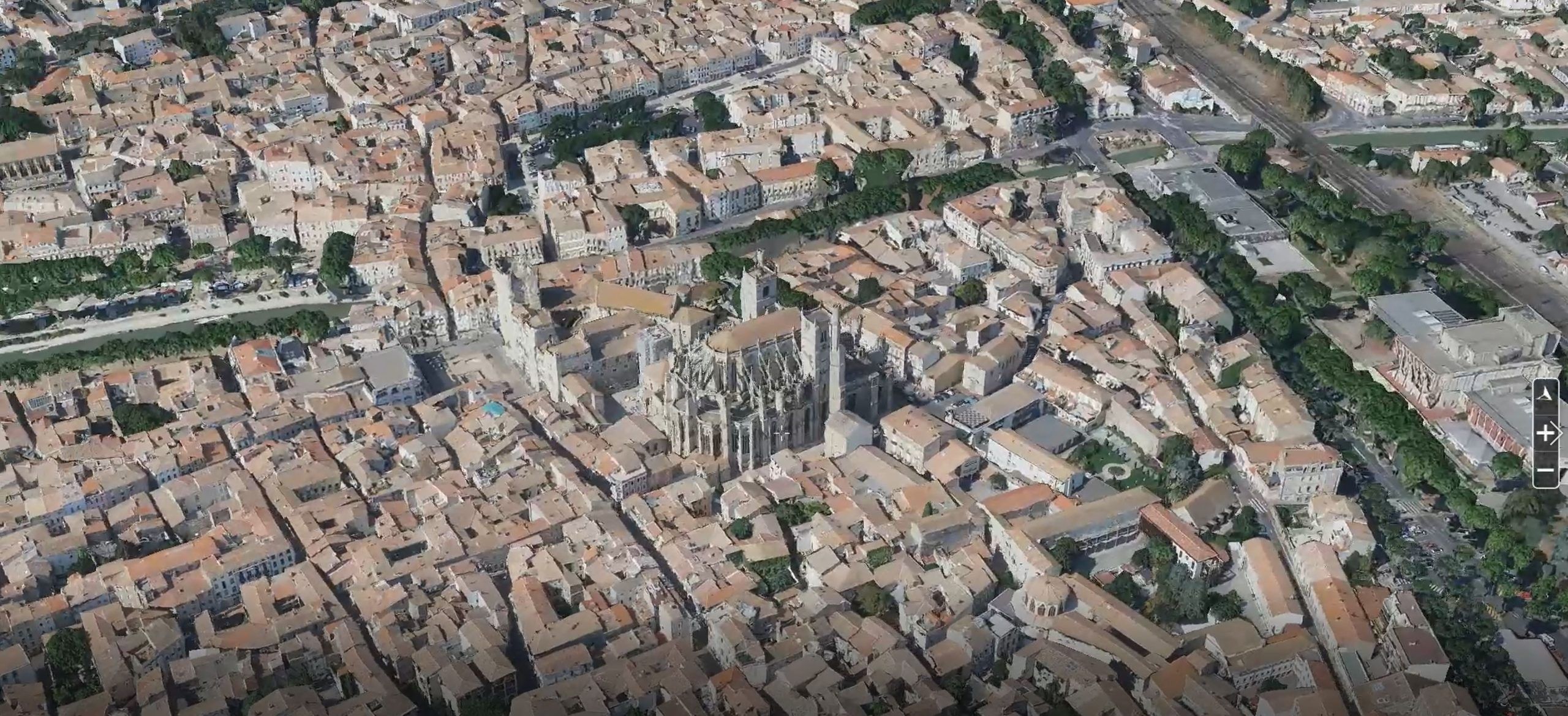
An innovative 3D digital twin on a departmental scale and with such precision
IGO presented the creation of a 3D digital twin of the Aude department, with a geographical precision and resolution of 3D images that are unique throughout the department. This innovative digital twin has been produced for the 1st time on this scale, with such precision and realism.
This is the ortophotoplan, or 3D photomaillage, created from aerial photos taken during the PCRS* program. It will enable these data to be used in other ways, in particular to meet the challenges of climate change, water and flood risk management, and the development and enhancement of rural areas(*PCRS – Plan de Corps de Rue Simplifié (Simplified street plan) piloted by IGN).
IGO structured dozens of TO (and Gigapixels) of data from the department’s images and lidar, which required very high computing capacities within IGO’s computing and storage space.
The digital twin will also be available for the ‘GEOSPATIAL SDK for UNITY 3D’ product presented by IGO at Laval Virtual to power video game applications and the Metaverse.
At the initiative of the Occitanie Region (European ERDF program), it will also be available in open data format, and will be posted on the Internet by the end of the year.
See also the article by SFPT – Société Française de Photogrammétrie et de Télédétection :
http://www.sfpt.fr/2022/09/jumeau-numerique-3d-du-departement-de-laude/