Pau, an ambitious Smart City initiative
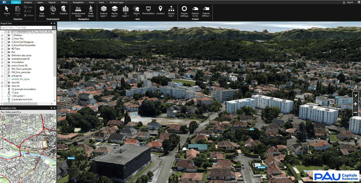
Pau has launched a consultation in 2019 to acquire aerial photography, lidar surveys, 3D photomaillage of its territory and emblematic buildings, and a 3D mapping platform solution. The city wanted an innovative approach, integrating the best technologies and services to enhance its territory and cross-reference all information through a collaborative real-time 3D geospatial platform.
A formidable communication and decision-making tool
The high-precision, high-resolution data repository will help contextualize the projects and challenges facing Pau Béarn Pyrénées. The 3D Terra Explorer platform, which integrates all these data repositories for the entire territory*, will facilitate access, the federation and sharing of information, decision support through cross-referencing with other data, and the development of uses and business applications.
* massive data – 3D big data: mesh, lidar point clouds, …
Find out more: Smart City & Digital Twin Capbp_City3D