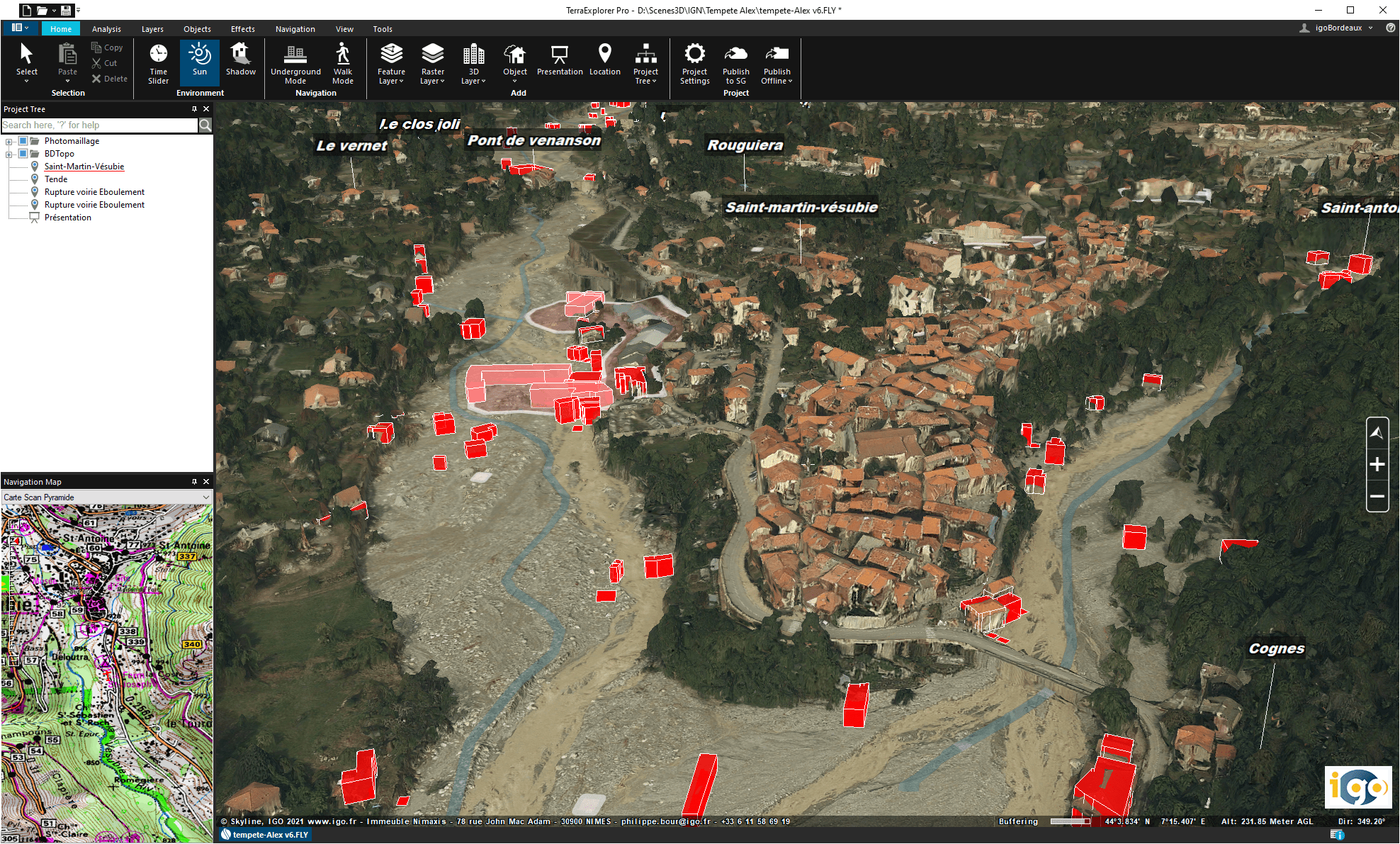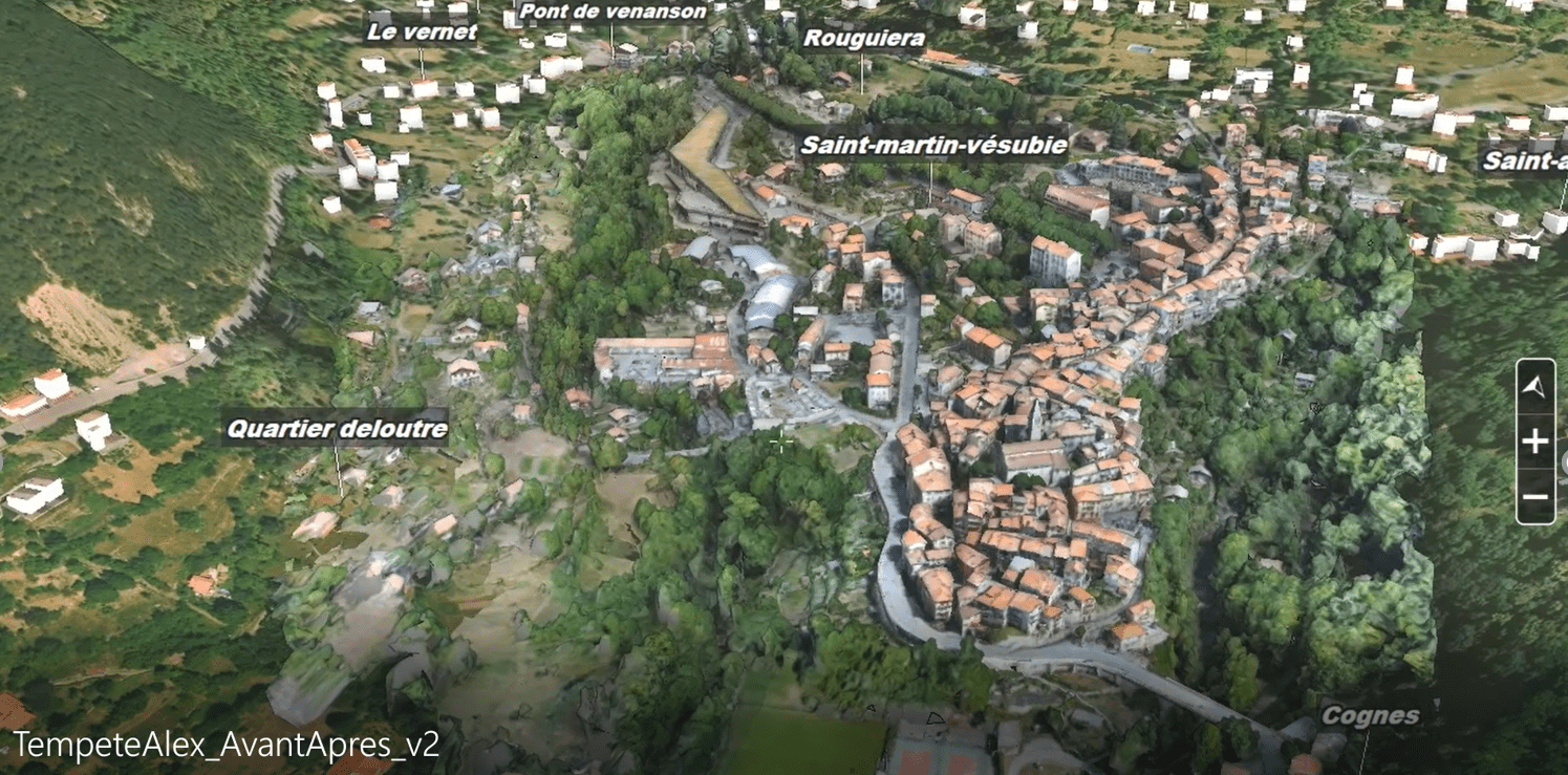
Understand, analyze and have a durable real-time 3D trace of the area immediately after the disaster.
IGO created the digital twin of the Vésubie based on IGN aerial images taken just after the disaster.
Restitution of the territory’s digital twin in just a few days
Technological resources and IGO expertise to create the 3D model of the area.
On-line with IGOGLOBE and analysis, measurement and simulation tools in record time.