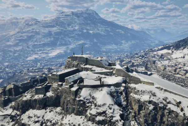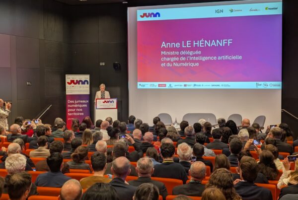
The Pays de la Loire region is accelerating its transition to more intelligent, sustainable territories thanks to the GEOPAL program. This ambitious project, which has been bringing together public-sector players in the field of geographic information for several years, has now reached a decisive stage: the implementation of a 3D software platform and the deployment of demonstrators, the prelude to the future digital twin of the region.
A 3D platform to federate data and prepare the digital twin
As part of GEOPAL, IGO is developing an innovative 3D software platform designed to centralize and visualize territorial data in real time. This step is essential to prepare for the eventual deployment of a complete digital twin, a virtual and intelligent replica of the territory, powered by connected sensors. Thanks to this tool, it will be possible to :
- Simulate scenarios to anticipate risks and optimize resources,
- 3D visualization of infrastructure conditions and surroundings,
- Make informed decisions thanks to accurate, up-to-date data.
With GEOPAL, the Pays de la Loire region, in consultation with the local authorities, is laying the foundations for intelligent management tools designed to make its regions more sustainable, safer and more resilient.
Demonstrator presentation
To reveal the full potential of the platform and prepare for deployment of the digital twin, four demonstrators have been deployed across the region. Co-constructed with major partners such as Ubicité, GEOFIT and CSTB, these pilots act as innovation gas pedals, testing new uses, validating advanced functionalities and prefiguring the services that will be made available on a large scale.
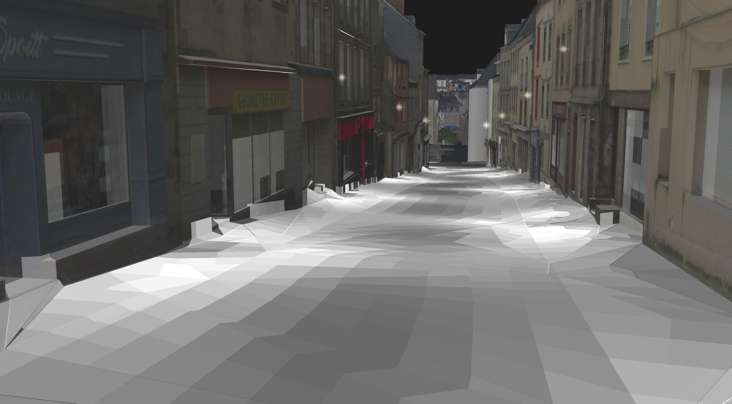
Optimizing public lighting in Mayenne
Objective: reduce energy consumption and improve visual comfort for more efficient energy management and a better quality of life for residents.
- Real-time monitoring of public lighting network status,
- Anomaly detection and automatic alerts for proactive maintenance,
- Scenario simulation to optimize lighting as needed.
Energy optimization at the Grand Port de Nantes
Objective: to comply with the tertiary sector decree and reduce carbon footprint through optimized energy management in line with regulatory requirements.
- Energy consumption monitoring (heating, ventilation, lighting),
- Data comparison to identify waste,
- Alerts and recommendations to limit consumption.

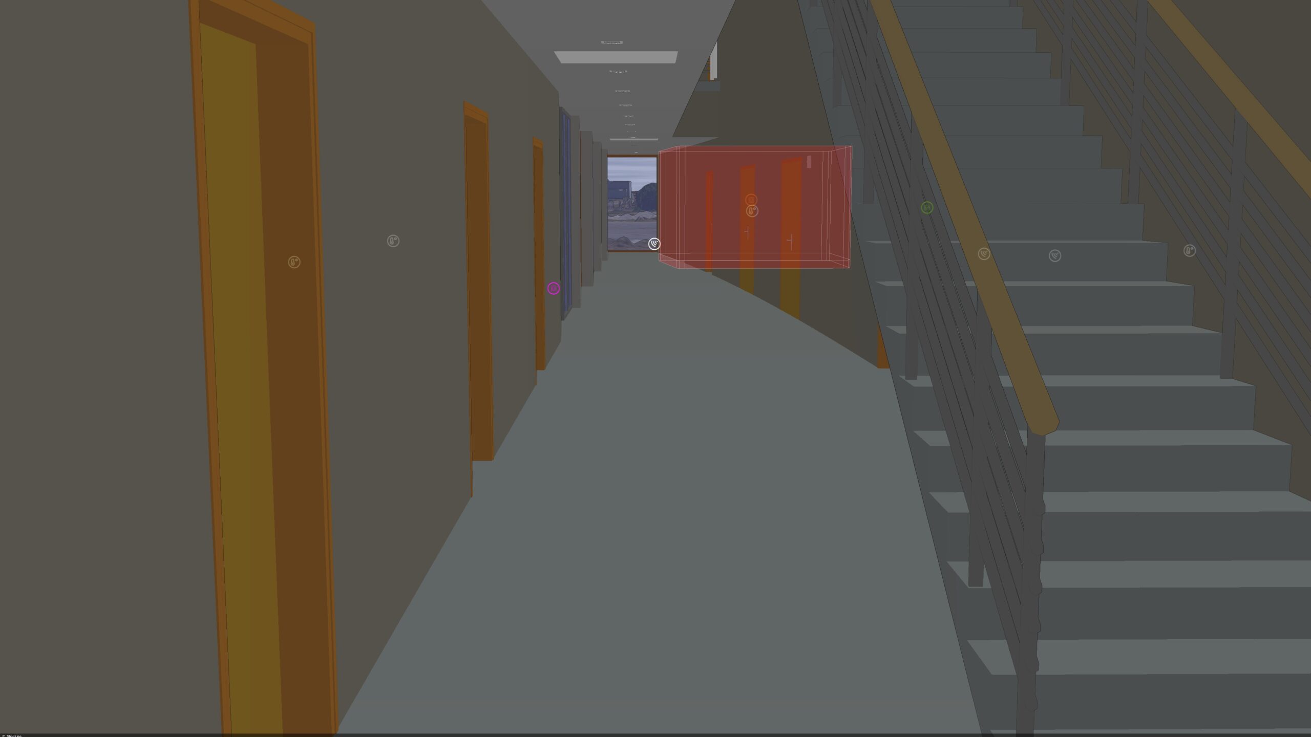
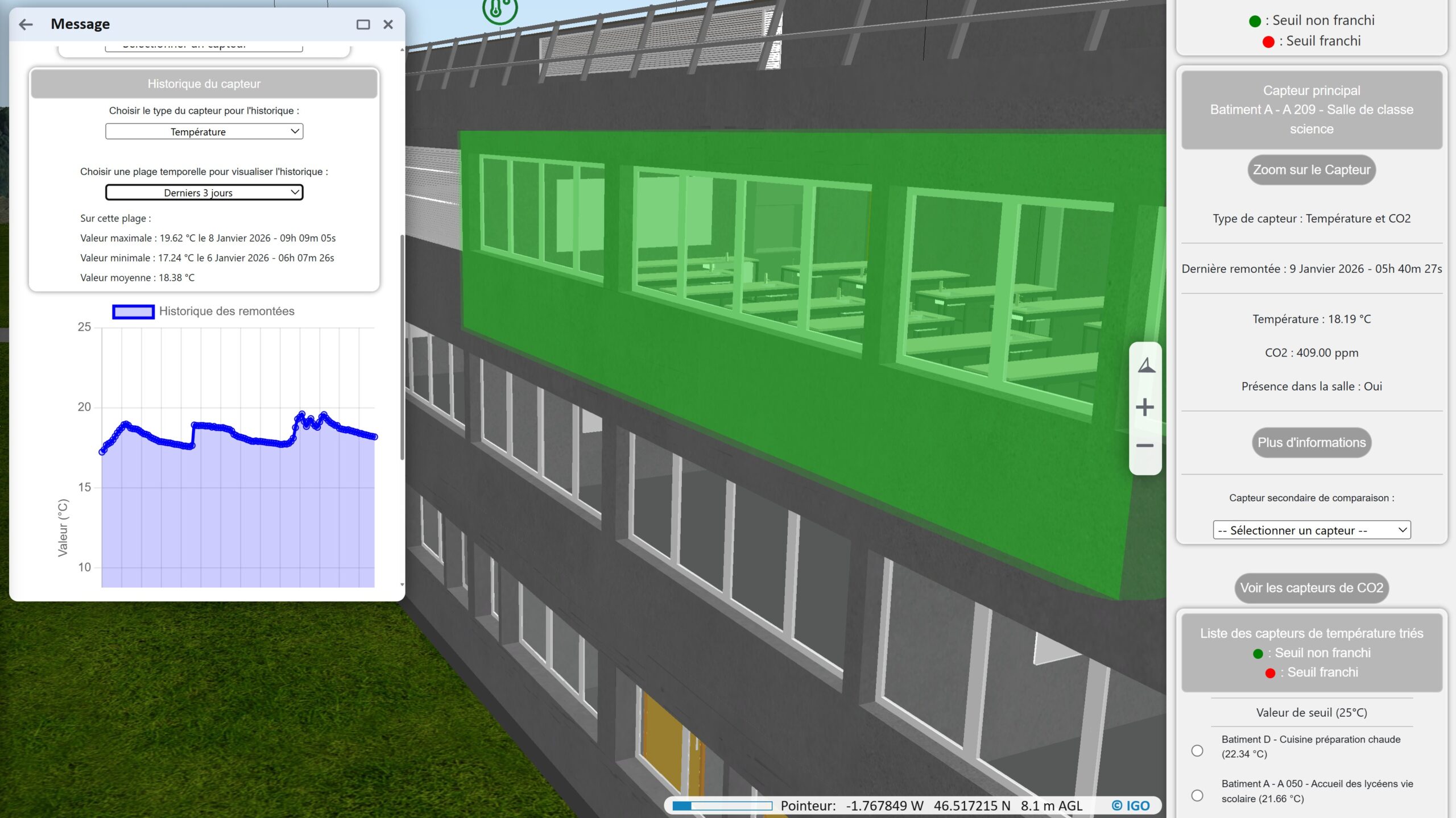
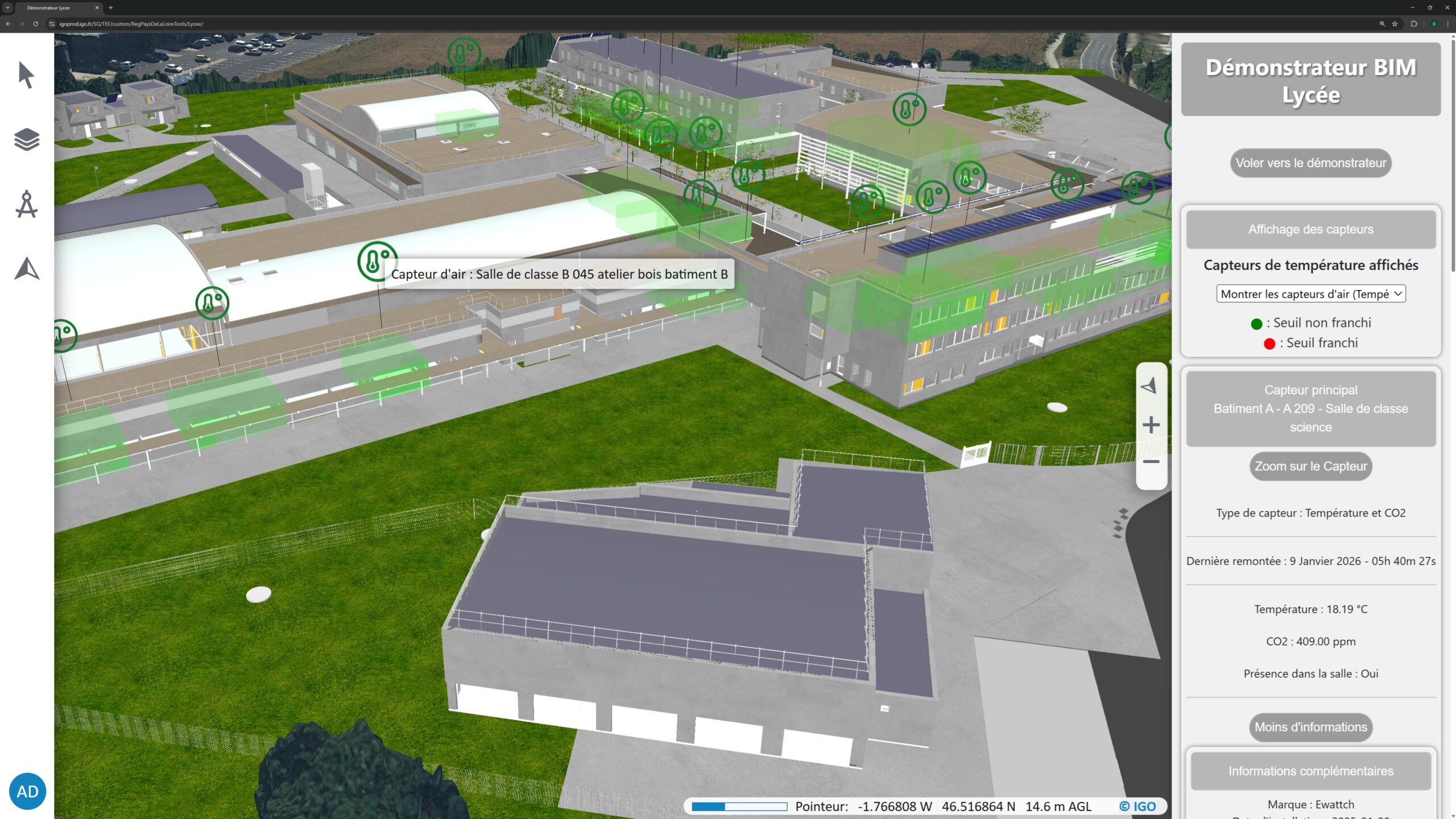
Air and water quality at Lycée Éric Tabarly
Objective: to guarantee a healthy environment for students and staff through proactive management of air and water quality, in line with health standards.
- Intelligent sensors measure air quality, temperature and water consumption,
- Legionella risk detection and real-time alerts,
- Automatic actions to correct anomalies (ventilation, maintenance, etc.).
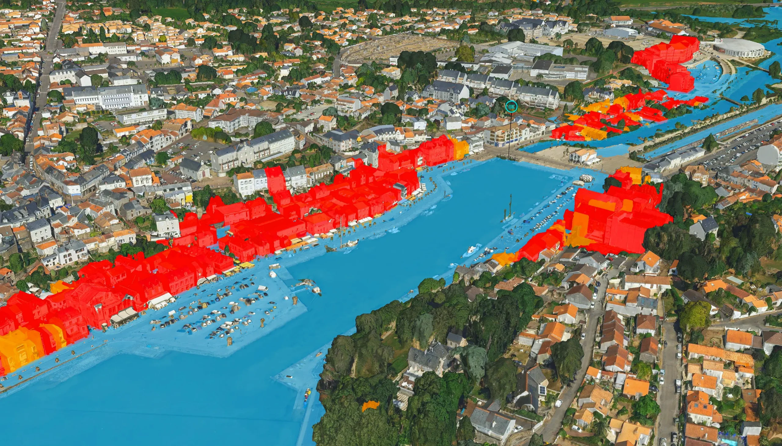
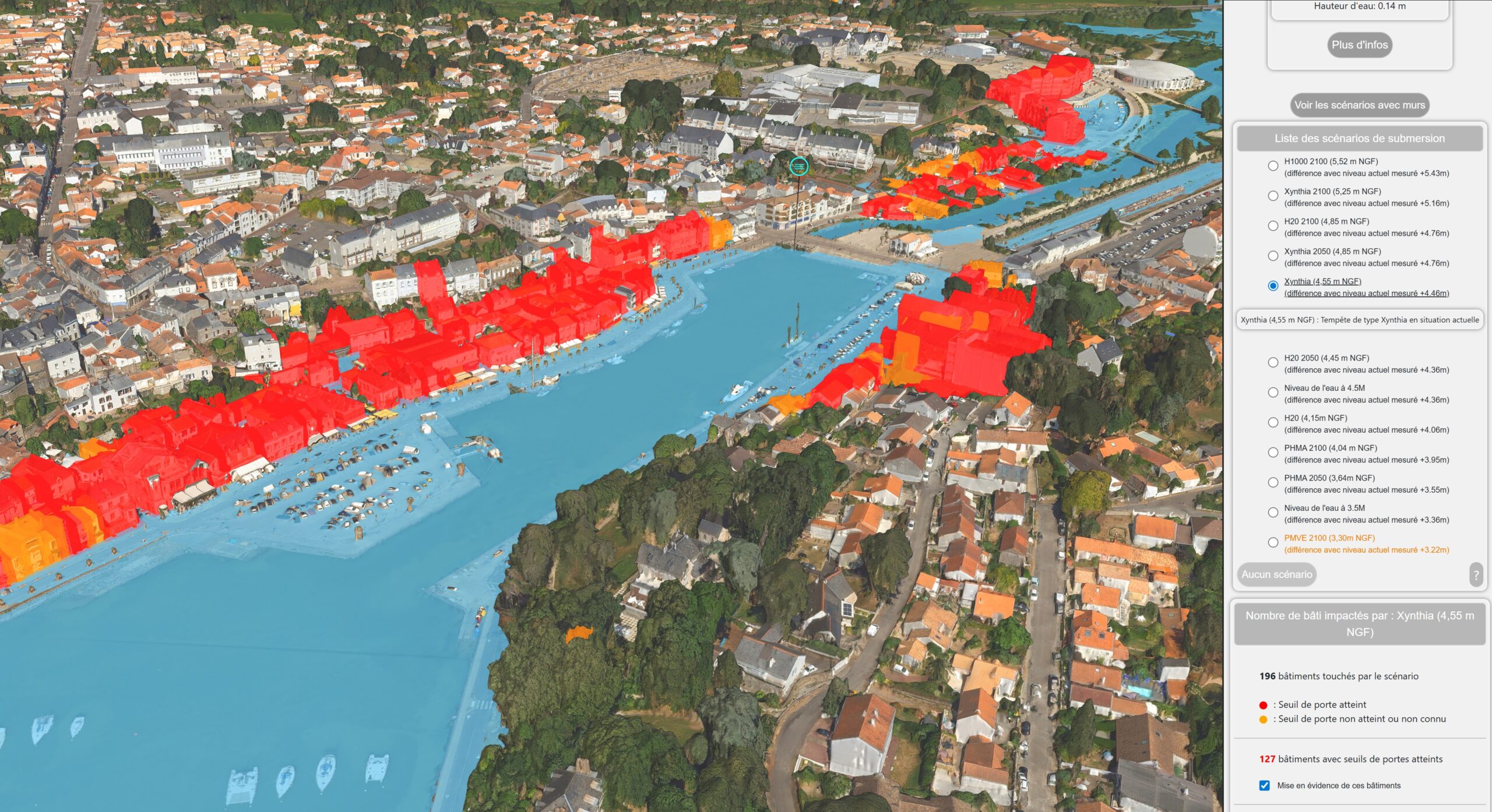
Preventing marine submersions in Pornic
Objective: to develop greater resilience in the face of climatic hazards and, in this specific case, to anticipate the risks of flooding and protect populations.
- Real-time water level monitoring,
- Simulation of flooding scenarios to assess impacts,
- Early warnings to evacuate and secure at-risk areas.
Discover the project in pictures by watching the video produced by the Pays de la Loire Region.
Next steps
This project does not stop with demonstrators. The next stages include the acculturation of uses with pilot communities, the integration of feedback to enrich functionalities, and finally large-scale deployment to meet local needs.
The project illustrates the Pays de la Loire Region’s commitment to innovation and ecological transition. Thanks to the digital twin, local authorities will have a powerful tool for managing their infrastructures intelligently, sustainably and securely.