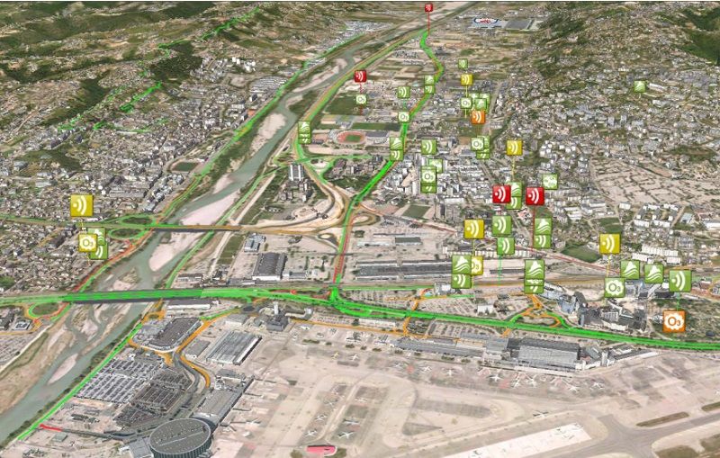
IGO’s 3D tools are used for Smart City experiments
Nice, ranked among the world’s top five smart cities (according to the Juniper Research 2015 ranking), provides a concrete eco-context conducive to innovation and emulation.
The territory is covered by a large volume of 2D and 3D georeferenced data, and the metropolis has chosen IGO solutions to implement a 3D web platform for the distribution and administration of its Geographic Information System (GIS) data.
The scalable, federative data platform meets the constant need for decision support (->internally) and territorial promotion (->externally).
The 3D platform is used in the Smart City Innovation Center’s various “Smart City” experiments, notably in Urban Environmental Monitoring.
To find out more…
Read the following articles on:
- Nice, 4th Smart City in the world, Juniper Research 2015 ranking,
- Opening of a Smart City Innovation Center in Nice, Usine Digitale article from November 2015,
- Urban Environmental Monitoring, IMREDD press kit