
3D TERRITORY
Model, merge and contextualize
Transformation of Big Data into Smart Data
It is the answer to the need to model and visualize territories in 3D, to contextualize patrimony and projects.Without size limit for automated formatting and integration of scattered and heterogeneous massive data:
- Bases & 3D models, digital twins
- 3D terrain meshes
- 3D CityGML Models
- BIM & Territories
3D BASE
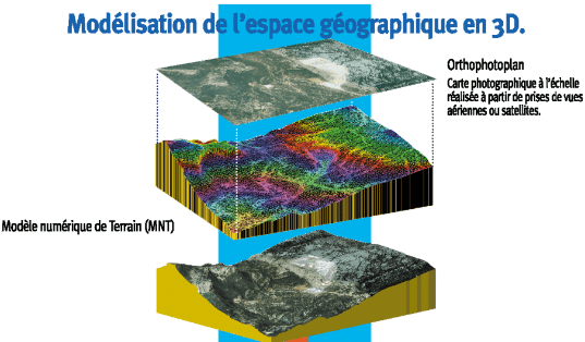
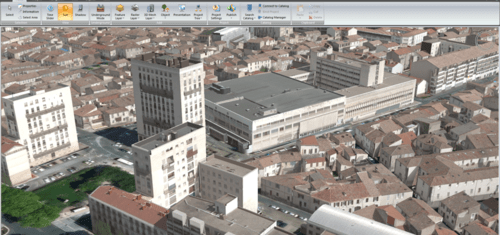
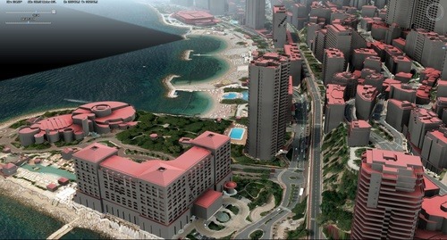
The 3D terrain is modeled using aerial or satellite photographs (orthophoplans) and digital elevation models (MNT, DEM, point cloud, Tin or Mesh).It is georeferenced and can be made up of orthophotoplans and terrains of different resolutions.It is structured (in mosaic) so as to be published in 3D streaming with great Internet performances and accessible on Smartphones & tablets.Locally on Deskstop or in Intranet / Internet distribution, the 3D Base allows an exploitation with extended functionalities: enrichment, data crossing, analysis… through interactive 3D digital models, tactile interfaces, applications or business platforms, a portal web, webservices, Virtual or Augmented Reality applications.Associated with the 3D model of buildings or infrastructures and vegetation, 3D Base is a real digital double or twin of the territory serving the Smart City or the Territories.
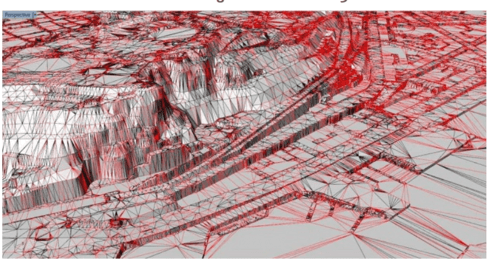
3D MESH
Triangulation with the optimal exploitation of MNT or DEM (grid or tin) without limit of precision, resolution and density of points for the creation of dense meshes.IGO uses Rhino Terrain and Rhinocity software to carry out elevation terrain meshing of its 3D bases.IGO develops business applications and interfaces (softwares) under Rhinoceros 3D for studying or analyzing terrain: water runoff …

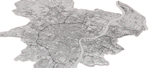
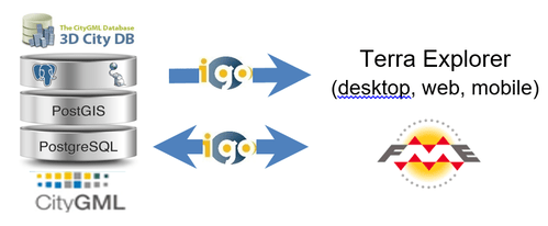
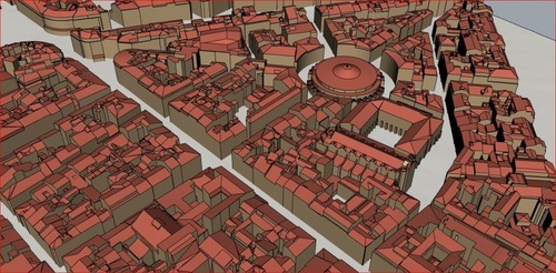
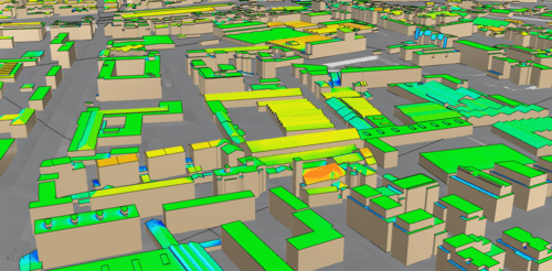
3D CITY GML MODEL
IGO masters FME, Rhinocity and Skyline Terra Eplorer tools to perform multi-format exports and create 3D models with CityGML standard as well as 3DML models: levels of detail (LOD1 to 4) in geometry and texture for 3D visualizations with great fluidity.
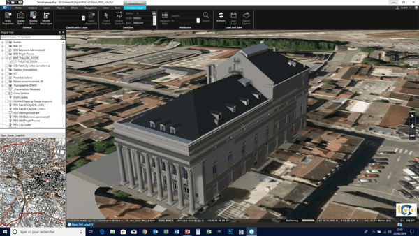
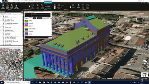
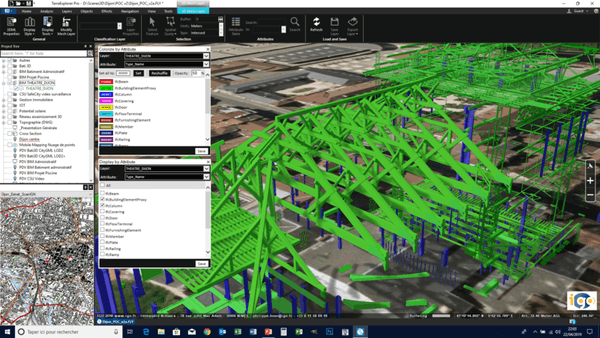
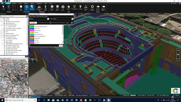
BIM & TERRITORY
IGO solutions make it possible to unite and visualize in a single interface all the BIM projects on a large territory (mainland, region, …) and cross all the information on this territory: BIM, GIS, patrimony, profession, …You can import unlimited BIM models from Revit or other software in FBX and IFC format for:
- Question all the elements (structures, materials, …) of the model and have their attributes in popup
- Create horizontal and vertical cuts of BIM models
- Visualize, navigate inside buildings
- Cross all BIM & GIS information
- Examine webservices platforms associated with CMMS management of BIM models
THEY USE 3D TERRITORY

VINCI AUTOROUTES
Accéder à l’information
Comprendre, partager et simuler

REGION OCCITANIE
SMART 3D TERRITOIRES
Infrastructures ports et aéroportuaires
Communication & Environnement

NICE
La ville connectée pour developper le territoire de façon durable et mieux gérer la sécurité

EVOLUTION AND SCALABILITY

WEB AND MOBILE ACCESSIBILITY IN REAL TIME

INTEROPERABILITY
