INNOVATION IS AT THE HEART OF THE STRATEGY
IGO develops its own solutions to meet the future demand of its customers:
- Fullweb visualization with WebGL / html5 standard on open source technology without software download
- Big data digital globe France and the world: 3D streaming, Cloud3D, IaaS …
- Photomesh or ORTHO 3D
- Virtual & Augmented reality
- PowerLine GPS (Grid Monitoring Solution)
IGO INVESTS IN COLLABORATIVE PROJECTS - CONSORTIUM OF COMPANIES

WATER RESOURCE
3D Hydroportal Project
PIAVE (Futur Innovation Program) subsidized by the stateLead partner: IGO, Partner: LDI, consultant specialized in hydrology and water resources and End-user partner: SMMAR, Aude watershed manager
The observation, the monitoring and management of water resources as well as the identification and mitigation of hydrological risk require the implementation of a multidisciplinary approach integrating the study of past events, the monitoring of present events and the forecasting of future events in the context of climate change.The data available and to come in the program of european monitoring satellites Copernicus Earth coupled with the other national and regional data sources represent an opportunity to improve the quantification of hydrological phenomena for the purposes of integrated watershed management.
Objective and uses
Develop an easily accessible collaborative geospatial platform to aggregate and distribute water data at all scales in real time and build services that meet the needs of water resource managers: consultation and awareness of the risk hydro-climatic, planning decision-making aid, coordination in prevention actions, anticipation and decision-making aid in crisis management, enhancement of manager’s actions, mitigation of the impact of climate change…
Results
To meet this transversal imperative, the platform allows multi-source “big data” data to be aggregated and cross-referenced at the scale of a watershed or region: spatial, terrestrial repositories, in-situ sensors and webservices.

SAFE CITY
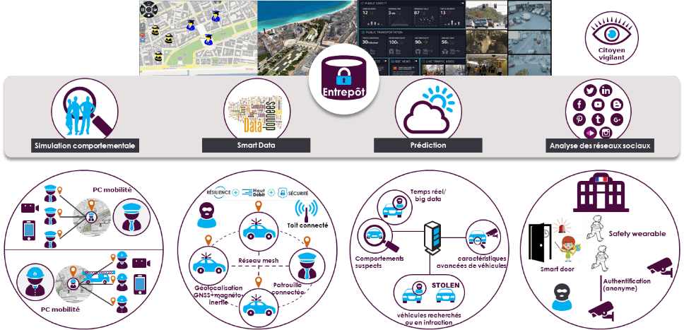
PIAVE (Future Innovation Program) subsidized by the stateLeader: Thales, Consortium of 15 companiesGoal
Improving smart city security by developing collaboration among all security actors – this is the Security Waze.
Enabling better assessment of each situation, anticipating incidents and crises and collecting as much existing data as possible and looking for correlations and weak signals – this is the big data of security, while guaranteeing the security of those data.
Strengthen the security of smart cities, particularly on the following axes:
- Data – New sources: social networks, citizens, analysis and correlation algorithms, video streams.
- The innovative shared situation view in 3D integrating the results of analyzes and simulations.
- Collaboration: a major stake of the Waze of security, the collaboration of security actors requires totally secure exchanges of critical data including on the move.
Role of IGOHMI interface and 3D display of the THALES SAFE Manager platform. Global supervision of the city with an overview of all the means deployed and their coordination in real time: raising alerts, viewing flows, simulations, etc.

SECURITY
Podium project
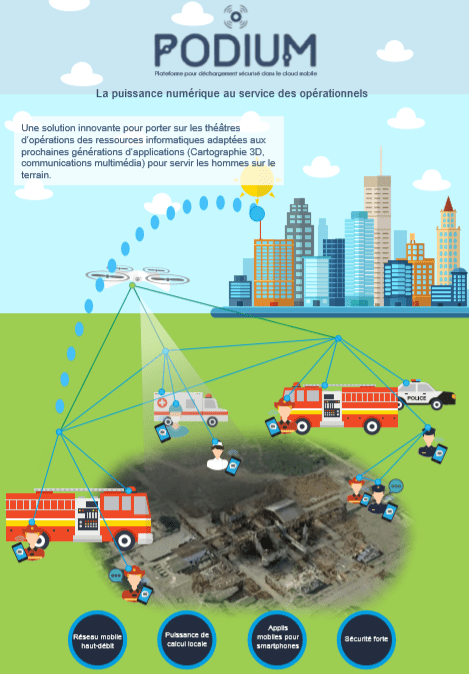
European FUI Leader: THALES in consortium with 6 companies.
GoalOffer first responders (Firefighters, Gendarmes, SAMU, special forces, …) innovative means of communication to manage crises or large-scale events in contexts where 3G / 4G networks are not available.Podium offers a dedicated Wimesh network allowing stakeholders to communicate at high speed with each other and with authority: creation of a mobile and resilient ad-hoc communication bubble, connection of drones, robots, vehicles, stakeholders, …
Role of IGO in the projectTools to quickly model a territory and 3D technology capable of interacting with referentials of terrestrial cartographic data and rapid updates from acquired data in the field:-> Generate tactical 3D maps from drone or terrestrial laser views and develop a SITAC directly in the 3D environment.

SPATIAL
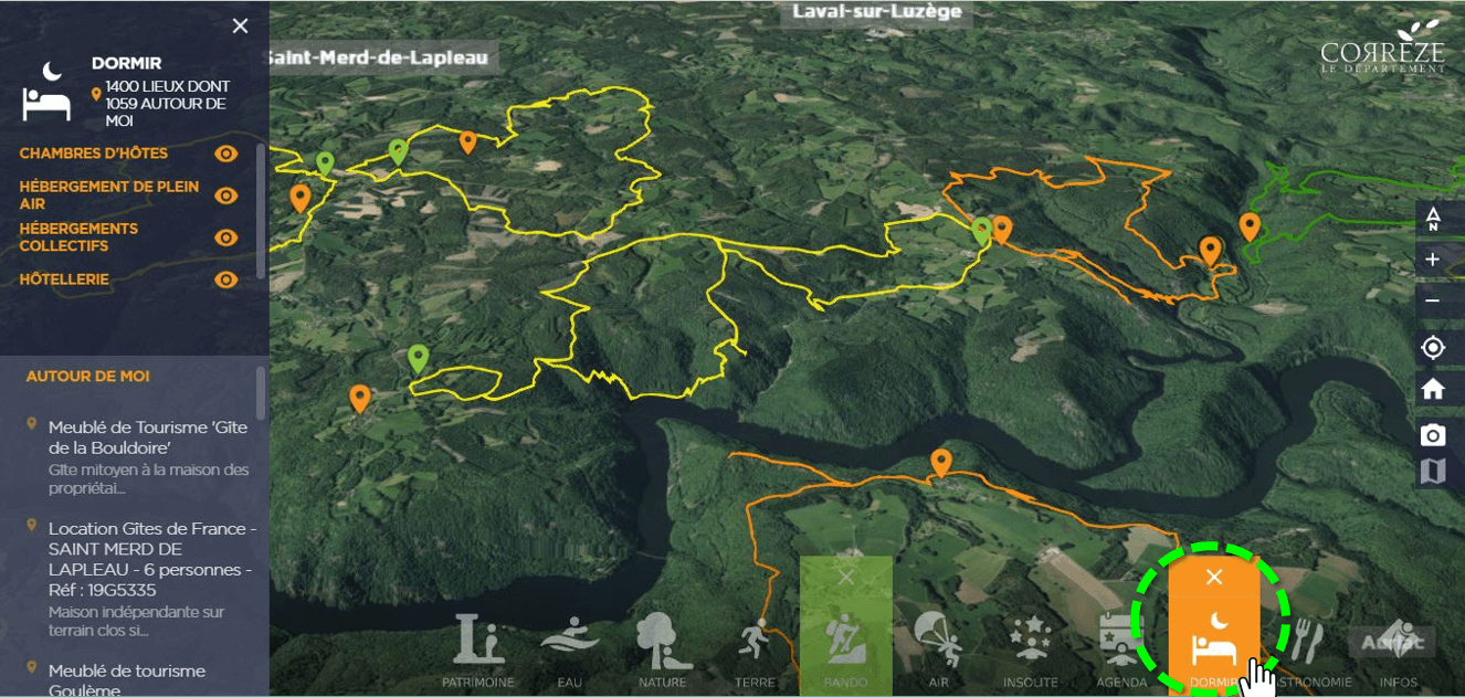
PROJECT- GEOTOURISM
Readynov programPartners: Inspace / Aerospace Valley, Région Occitanie, Meoss, UGAP
GoalBoost the use of spatial data by cities and local governmens for their tourism and economic development.Unique fullweb 3D interface to access information and webservices.

