Predict Service’s core business is to provide users in areas threatened by climate risks with integrated, personalized assistance in managing these phenomena (floods, storms, marine submersions, heatwaves, etc.). To achieve this, Predict Service has collaborated with IGO to develop solutions that combine preventive action and climate risk analysis tools. This makes it easier to anticipate and manage risks on a fine scale, and to set up warning and decision-support systems.
The project
Initial customer request
Project objectives
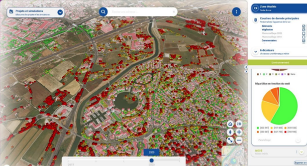
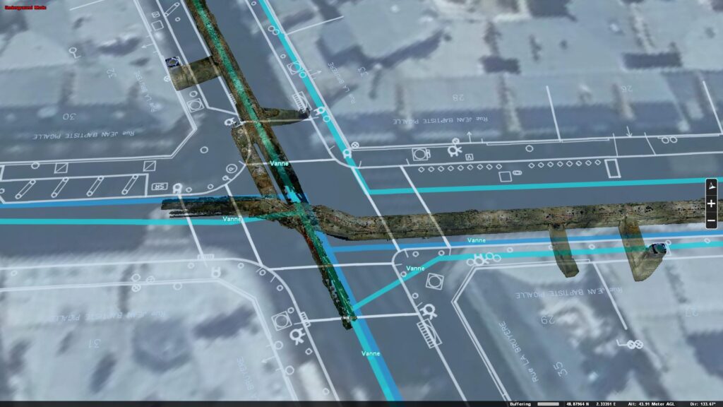
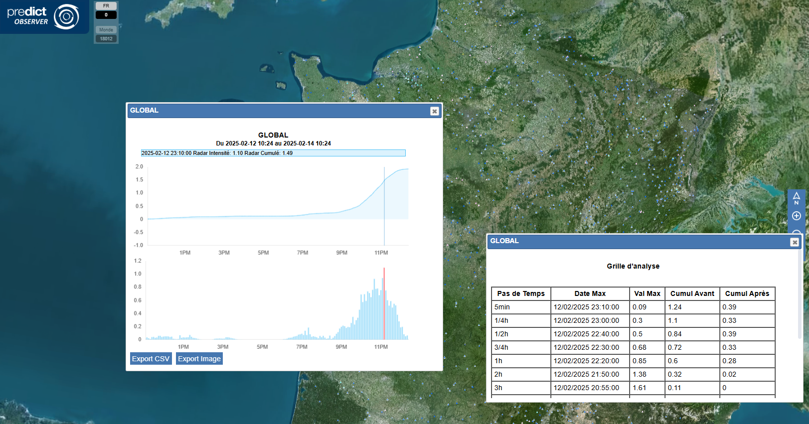
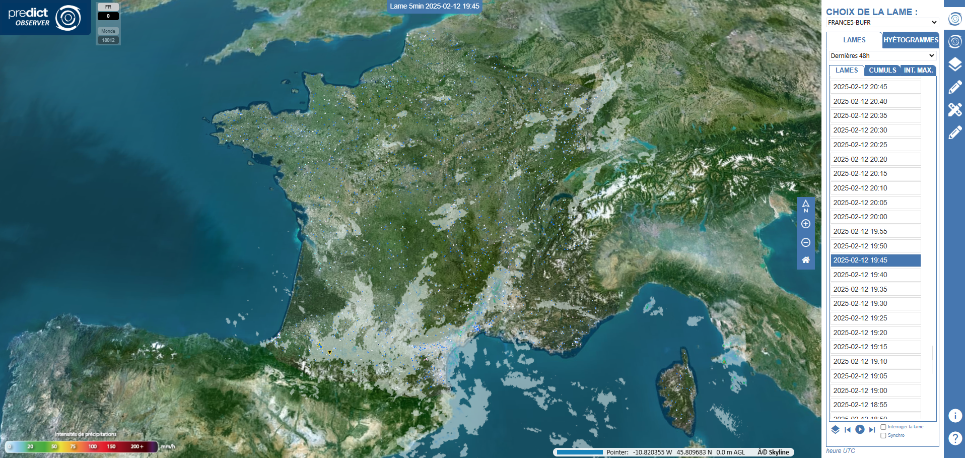
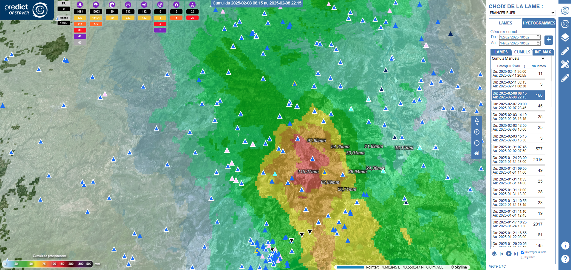
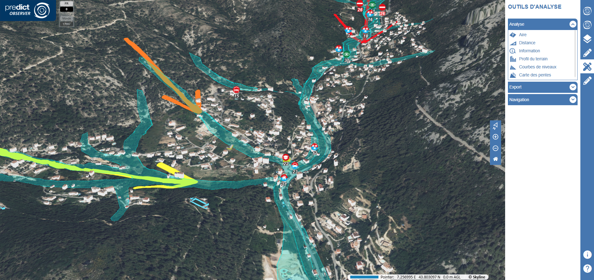
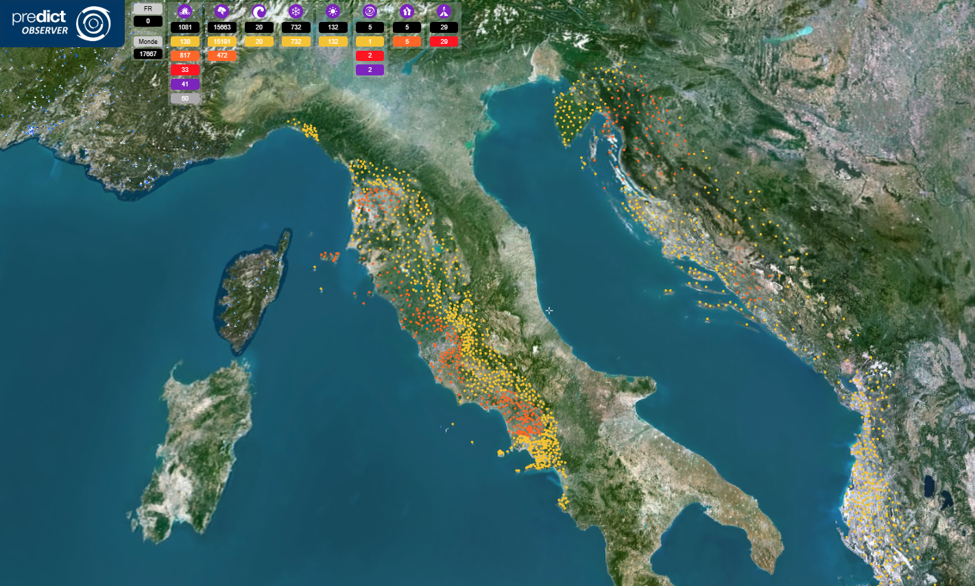
The aim was to develop a powerful tool to help Predict Service make decisions before, during and after a crisis. This tool can handle a wide variety of data at different scales. It can be used for general monitoring, displaying precipitation at national level. In the event of a crisis, it is possible to zoom down to ground level to visualize the issues at stake and the resources available to manage the situation. 3D visualization is an essential asset, providing a better understanding of the terrain and enabling the most at-risk areas to be anticipated. What’s more, much of the data is updated in real time.
Challenges met by IGO
Real-time data operation.
Robustness: the system must be operational 24/7.
Data size :
-
- France: Rainfall data with a resolution of one point per km², updated every 5 minutes.
- World: Rainfall data with a resolution of one point every 25 km², updated every 30 minutes.
Data accuracy :
-
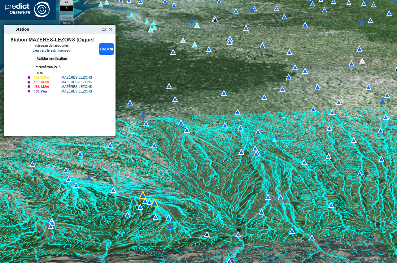
- The data must include precise information on the ZMI (Zone de Mise en Œuvre), PCS (Plan Communal de Sauvegarde), and buildings (“shoebox” representation).
- This data must be available worldwide.
Real-time analysis of all stations in France.
Points display :
-
- Ability to display between 0 and 150,000 points on the globe.
- Points must be visible at any scale.
- The points list is updated every 60 seconds.


1000000
of rain cams processed per year in real time
50
users
40000
stations monitored in real time in France
”Generally speaking, hazard/risk cross-referencing, while feasible in 2D, is improved in 3D thanks to the contribution of the topographical dimension and therefore of the potential impact of slopes on the vulnerability of territories.
Julien LAMOURETDirecteur Systèmes, PREDICT Services
